Showing posts with label southern california. Show all posts

Saturday, May 24, 2014

A Walk In Paradise At Planet Mars, in Planet Earth, California

A walk in paradise?
Or a walk in planet Mars?
Amboy Crater National Natural Landmark

Thursday, March 27, 2014

Coast Live Oak

Trees for Fun Friday. This week, I am featuring the coast live oak, which is native to the coast ranges of California.
Coast Live Oak Woodland, Trail to Mt. Woodson, San Diego County
Coast live oak is the only native California oak that thrives in the coastal environment. It is somewhat tolerant of sea salt present in the coastal winds. Though live oaks are rarely found in the immediate shore, they usually are found in well drained soils of coastal hills and plains. It may be found in several coast live oak woodland communities such as in Blue Sky Ecological Reserve, in Poway, San Diego County. 
Coast Live Oak Woodland, Blue Sky Ecological Reserve
Coast live oak are normally found within 62 miles from the ocean and at an elevation below 2300 ft, however, in Southern California, the coast live oaks are occasionally seen up to 5000 ft elevation.
Coast Live Oaks Lining Potato Chip Rock at Mt Woodson, @ 2800 ft elevation
On top of Potato Chip Rock with Coast Live Oak Behind the Rock
Coast live oak is an outstanding bird plant and is a food plant for the California Sister butterfly and mournful duskywing. 
Red Tail Hawk Resting at a Branch of Coast Live Oak
Aside from the coastal live oak which is native to the coastal region of California, there are many other live oaks, which is a general term used for unrelated oaks, but share the same characteristic of evergreen foliage. The name "live oak" comes from the fact that the evergreen leaves remain green throughout the winter, when other oaks are leafless and dormant. 
Wildflowers and Coastal Live Oak @ Blue Sky Ecological Reserve, Poway, San Diego County

Friday, March 07, 2014

Cactus Monday- Borrego Palm Canyon Nature Trail

Anza Borrego Desert State Park, San Diego County, CA
The hike:
     from the visitor center: 5.5 miles round trip, 600 ft elevation gain (no fee to park at visitor center)
     from Borrego Palm Campgrond: 3 miles round trip, 600 ft elevation gain ( there is $8.00 day use fee to enter campground )
This is the most popular trail probably in Anza Borrego Desert State Park, and is also good for beginners because the ascent is very gradual, and the trail is well maintained. Though some parts of the trail would require some boulder hopping, because of the big rocks that litter the ground. Most parts of the trails are rocky, but very manageable. 
Desert Nature Trail, Visitor Center
The peak visitation to this park is during winter and spring when the temperature is cooler. In the summer, because of the intense desert heat, the trail is more isolated. Though at other times of the year, the hike here can be drab for some, because there is nothing but sun-blasted vegetation. But during spring, March and April, this park can turn into a rainbow of colors.
Blooming Beavertail and Brittlebush

Monday, February 03, 2014

The Joshua Tree

We are now on our 6th week of Trees for Fun Friday. We are featuring trees for 8 weeks, and in this last 3 weeks of Trees for Fun Friday, I am featuring 3 California Trees where a National Park has been named for them. The first of these 3 trees is the Joshua Tree.
Joshua Trees @ Sunset, Joshua Tree National Park, CA
The Joshua Tree, Yucca Brevifolia, grows wild primarily in the Mojave Desert. The Joshua Tree is the largest of the yucca family, and like all other members of the yucca family, is part of the lily family. Joshua Tree is native to Southwestern United States, in the States of California, Nevada, Arizona and Utah. It is confined mostly to the Mojave Desert between 1300 ft and 5900 ft in elevation. The Joshua Tree National Park is named for the Joshua Tree forests native to the Park. The legend is that the Joshua Tree is named after the prophet Joshua by the mormon migrants because of how the limbs of this monocot tree is outstretched in supplication like in a prayer.
Can You Find Me Here? Hands Raised like the Joshua Trees
**I had to jump high to be seen :)  **
Years ago, when ranchers and miners arrived in the area with high hopes of raising cattle and digging gold,
Barker Dam @ Joshua Tree National Park
( built by ranchers in a natural rock catch basin to store water for cattle)
they used the Joshua tree limbs and trunks for fencing and corrals. Native Americans used the tough leaves for baskets and sandals. The raw or roasted flower buds and seeds of Joshua tree were part of a healthy diet.

Rock Climbing @ Joshua Tree National Park
Today, the Joshua Tree National Park not only protect these grotesque trees but also 501 archaeological sites, 88 historic structures, 19 cultural landscapes and houses 123, 253 items in its museum collection.

And, being a U2 fan, I also own a Joshua Tree album, which was named also after these trees. There is so much diversity at Joshua Tree National Park, I hope to be able to share some more other features that this National Park offers in my later posts.

Sunday, September 22, 2013

Los Angeles to San Diego

This is Day 4 of the 6-days Las Vegas- Los Angeles- San Diego road trip via Death Valley National Park and Palm Springs.  I have not personally done this road trip but just using my experience of these 3 cities on what natural wonders can be more realistically explored with these 3 cities in 6 days. This series of posts is in response to several queries for a nature + cities sightseeing tour of Las Vegas-Los Angeles-San Diego for 6 days.

A little bit of summary:
Day 1- getting to Las Vegas. Las Vegas is the closest international or major airport for Death Valley National Park and also the Grand Circle (Grand Canyon National Park, Zion National Park, Bryce Canyon National Park, ++ more ).  Probably this is the reason why most queries usually are for nature exploring that starts and ends at Las Vegas, because it is the busiest international airport (which means more airfare deals) closest to most NATIONAL PARKS. Not all who go to Vegas stays in Vegas, they explore nature's wonders.

Day 2- Las Vegas to Death Valley National Park

Day 3- Death Valley National Park to Los Angeles
            first half of the dayDeath Valley to Alabama Hills
            2nd half of the day: Alabama Hills to Los Angeles

Now, on to day 4, which is from Los Angeles to San Diego, my home sweet home.....
Los Angeles (top), San Diego (bottom)
Though there may be a lot of places to explore in these two cities, both cultural and natural, however, I will be sharing only places here which I believe could be realistically explored in such a short time. 

The challenge is the drive from Los Angeles to San Diego. If it falls on a weekday, though these two cities are only 120 miles apart ( 2 hours drive ), but the drive could be 3 to 4 hours or more for an unknowing traveler because of the heavy work commute traffic in Los Angeles. To avoid the work commute or peak traffic, one must drive from Los Angeles to San Diego between 10:00 am- 1:00 pm. One can leave early in the morning, say at 5:00 am too, but it sounds tough considering you may have spent night wandering in LA!

This post, assumes you leave Los Angeles at 10:00 am, and what could be realistically explored.

First, if you happen to get up and already up and about at 8:00 am, what should you do if driving to San Diego at this time is not yet recommended because of crazy LA traffic? First, you could have an early morning brunch at LA, actually, whenever at LA, I always have early morning dimsum at Chinatown because their dimsum there is really like no other! After dimsum, you could goof around downtown LA again, one of the places I love goofing off at LA for some fun photography is at Disney Hall. It may still be closed, but you could wander around the vicinity.
Me, Goofing Around @ Disney Hall, Los Angeles, CA
( this was taken early morning, the Hall was still closed, went here actually, before going home to San Diego )

After brunch, climbing up and down Disney Hall, am sure it is about time to leave for San Diego. Take Interstate 5 South To San Diego, if without traffic, you should be in San Diego about noontime, if you did not stop anywhere else. However, if you are not in a hurry to reach San Diego, and would want to drive along the coast to experience what Southern California beach cities are like, you can take the connecting freeway to Huntington Beach or Newport Beach, then, drive along Pacific Coast. This drive may be long, but oftentimes, I am asked "can I drive along the coast most of the time from Los Angeles to San Diego?" The answer is yes, . If you do love the ocean so much and want to experience the character of every Southern Californian beach city, you can follow this driving itinerary: Los Angeles to Huntington Beach-Newport Beach-Balboa Island-Corona Beach- Crystal Cove State Park- Laguna Beach-Dana Point- San Clemente, then, back to Highway 5 for San Diego. 
Huntington Beach-Crystal Cove State Park-Dana Point- San Clemente, Orange County, CA

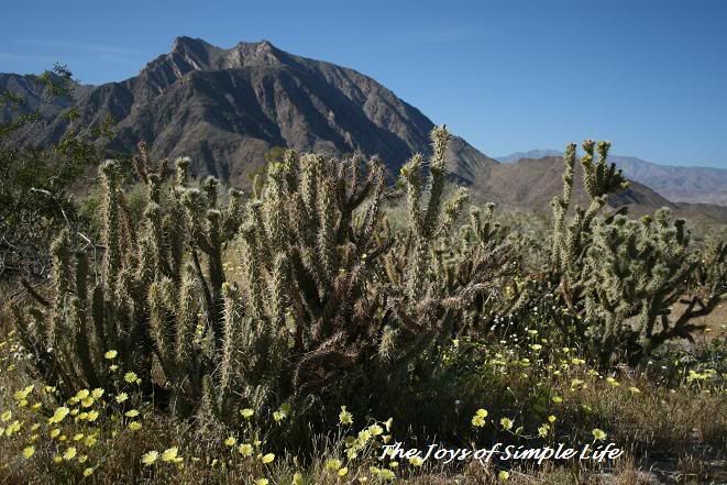
If you'll take the coastal route ( Pacific Hwy 1 instead of I-5), you'll probably reach San Diego in the afternoon. If you so happen to take this road trip in spring ( best to do this road trip is from late fall- early spring, November to April, because Death Valley and Palm Springs would be very hot May-October being in the middle of the desert ), your first stop once in San Diego is Carlsbad Flower Fields.
Carlsbad Flower Fields, San Diego County
( spring time only )

Wednesday, September 12, 2012

Rediscovering LA, part 2

Grapes @ Gainey Vineyard
In part 1 of Rediscovering LA, I ended my post with Gainey's Vineyard. In this post, I will start with a hike at Malibu.
Because I am not very familiar with hikes in LA, my cousin chose the place to hike. She chose Solstice Canyon Deer Valley Loop Trail with a short side trip to the Robert's Ranch House Ruins. The hike is 6-mile round trip with 1000 ft elevation gain. The trail winds through chaparral, coastal sage, oak woodlands, and grassy meadows. 
Oak Woodland at Solstice Canyon, Santa Monica Mountains National Recreation Area

Monday, August 27, 2012

K Ka-Boom at Kelso Sand Dunes

Nature has its special way of always bringing out the child in us. There is just so much to experience in our natural world. On our way home from Utah during our last thanksgiving trip, my husband asked if there is another sand dune we will pass along the way that we have not seen yet. Hmmm, sand dunes again? There is just something with the sand that draws us into it, it may be the inspiring artistical ripples wonderfully carved by the wind, or it may be the complexity of how it was formed, or it may just simply be enjoying the different gifts and the many faces of our wonderful world.
Me @ Kelso Dunes, Mojave National Preserve, California

Sunday, March 18, 2012

Fresh Water Tilapia Adapting to High Salinity in Salton Sea

White Sands (?) @ Salton Sea State Recreation Area Shoreline
From afar, the Salton Sea looks very inviting: white sand, blue skies, diverse species of resident and migratory birds, wildflowers swaying beautifully, 
Wildflowers Blooming @ Salton Sea Shoreline
and sparkling blue sea that is bordered by desert mountains. It looks like a piece of heaven. A refuge for wildlife. 

Friday, March 16, 2012

Salton Sea: The Accidental Sea

On our way home to San Diego from Indian Wells, CA where we spent our weekend watching BNP Paribas Open, we took a longer route home via the Salton Sea
 Salton Sea

 to North Algodones Sand Dunes, or Imperial Sand Dunes then back to San Diego. 
North Algodones Sand Dunes
The Salton Sea is one of the world's largest inland seas and one of the lowest spots on Earth at -227 ft.

Saturday, February 25, 2012

Terns

Terns, La Jolla Shores Beach, San Diego, CA
California least tern is a subspecies of the least tern that breeds on Atlantic East Coast from Maine to Florida. The California least tern is a migratory bird that breeds primarily in the bays of the Pacific Ocean, and is federally listed as an endangered species. 
The number have gradually increased from 582 breeding pairs in 1974 with its protected status, but these migratory birds are still vulnerable to natural disasters or further disturbance by man. 
These small migratory birds once nested widely along the central and southern California coast and the Pacific coast of Mexico. Nesting today however is limited to colonies in San Francisco Bay, Sacramento river delta, and areas along the coast from San Luis Obispo county to San Diego County. The greatest concentration of breeding pairs nest in Los Angeles, Orange and San Diego Counties. 

CA least tern need to nest close to the shoreline areas where their prey is abundant. But these places make them more vulnerable to predation and human disturbance. American krestels, burrowing owls, feral cats, nonnative red foxes, crows and other predators take their toll. If their nesting ground is near developed areas, domestic cats, and human-tolerant native species such as racoons prey on them. 
CA least tern is a small seabird, measuring 10 inches in length and a 30 inch wingspan when fully grown. They have black-capped and black-tipped head. They have pale gray wings, white body, yellow bill and yellowish feet. They feed in shallow estuaries or lagoons where small fish are abundant, such as smelt, anchovies, silversides and other small nearshore prey.


Thursday, February 23, 2012

One Fine Day @ La Jolla Shores

 
All pictures above were taken last Saturday, February 18, 2012, by my hubby, who I believe, had a time of his life laughing, giggling, and was giddy like a little boy enjoying the gifts of nature. All the pictures were taken from our relaxing and fun walk at La Jolla Shores. If you want to know more about La Jolla Shores and is curious with how my photos compare, please visit my post  La Jolla Shores at The Salitype Society.

Friday, February 17, 2012

Santa Barbara: Not Just Another Beach Get Away

Anacapa Island, Channel Islands National Park, off Santa Barbara Coast, CA
Santa Barbara, CA is one of the quiet escapes in Southern California. It is a popular nature get-away for most Los Angelenos because it is only about 2 hours away from this very busy and crowded city. Though Santa Barbara is very close to Los Angeles, yet it feels a world apart. This not so small but quiet town is sometimes referred to as the American Riviera, what with her beautiful sparkling beaches, majestic mountains and colorful culture. 
Hiking @ Anacapa Island
Santa Barbara however, is more than just beach, sands and surf. World class Santa Barbara vacation homes, premier resorts, fine dining, historical places, culture, great night-life, hiking, surfing, and many more outdoor activities await every visitors. Though offering both indoor and outdoor vacation, Santa Barbara is a great place for those who enjoys being OUT! From the city of Santa Barbara, visitors are just minutes away from the wine country, with majestic wine vistas which probably you may have seen from the Amazing Race. Though Santa Barbara is a great place for surfers, boogie boarders, paddle surfers and kayakers, but this quaint charming town offers water, land and air outdoor recreation. 
Rollings Hills, Mountains and Clouds Above Pacific Ocean
Heading for the hills and mountains, visitors can be almost 2,5000 ft above sea level overlooking the Pacific Ocean. If visitors want to fly their dreams high up in the sky, with a few hours training, they can get a birds-eye view of the Pacific coastline along Santa Barbara coast paragliding their way to a vacation of a lifetime.    
Paragliding
Visitors can immerse themselves in the migration of the Monarch butterfly, or scan the Pacific ocean for whales, 
Pacific Gray Whale
or visit a world so different yet so close at Channel Islands National Park. 
Sea Gull on a Bed of Goldfield @ Channel Islands National Park, CA
Doesn't that sea gull seem to be calling you to enjoy Santa Barbara and its magical natural world nearby? If you do come visit, a short day trip from Santa Barbara is Big Sur, 
McWay Falls, Pfeiffer Burns State Park, Big Sur, CA
McWay Falls, one of the few waterfalls on Earth that is right next to the sea!
where the ocean,mountains and clouds kiss each other wonderfully!
Big Sur
If the call of fine dining, culture, amazing outdoor opportunities, wildlife, mountains, ocean do call you, Santa Barbara is just 2-hrs away from Los Angeles International Airport, or minutes away from Santa Barbara Airport. 
Elephant Seals on Point Piedras Blancas, San Simeon State Beach
you will hit this place before you reach Big Sur when you are driving from Santa Barbara 
 And when you are vacationing in beautiful, scenic and quiet city of Santa Barbara, don't forget to also take one of the world's top ten drives of a lifetime listed in National Geographic and Travel magazine, Big Sur, which is as close as you can get when you are in Santa Barbara. 

Monday, December 12, 2011

Barker Dam Loop Trail, Joshua Tree National Park

Barker Dam, Joshua Tree National Park
Mileage: 1.5 mile loop 
Difficulty: Very Easy level walk (with only about 100 ft elevation gain), however, for those who wanted to add challenge can scramble up in this rocky wonderland trail.
Trailhead: Park Blvd (12 miles west of the intersection with Pinto Basin Road), Joshua Tree National Park, CA ( less than 2 hours drive from Los Angeles or San Diego, a few minutes away from Palm Springs )
Me and Joshua Tree
The Barker Dam Loop Hike is a fun and easy hike for all members of family. There are two trails that cross at the trail head, be sure to follow the signs that lead to Barker Dam. In the first part of the trail, you will be passing Joshua Trees, which are the largest of the yucca family and grows primarily in the Mojave Desert. 
 Joshua Tree 
Joshua Tree and all other yuccas are members of the lily family. Notice in the picture above how the limbs of the yucca bend down already from its weight. Joshua Tree National Park is world famous for rock climbers though it started before as winter ground for Yosemite rock climbers. It is not a surprise to see rock climbers dotting the surface of the rocks as you walk on the trail to Barker Dam, or anywhere in the Park. 
 Rock Climber at Joshua Tree
Want To Rock Climb?
 We are not technical rock climbers, however, whenever there is an opportunity to scramble on rocks and boulders, we love doing so. There are many opportunities for rock scrambling and bouldering in this park. The Barker Dam Loop Trail is in interpretative trail, and if you pay attention to the signs, you will not miss the petroglyphs that have been left behind by past civilization, but have been vandalized or painted over :(
 Petroglyphs Painter Over :( 
 After a short while of walking in the midst of wall of rocks and Joshua Trees, the calm blue dam (or much more like a pond) is very welcome sight.
Barker Dam
This dam is a naturally enclosed area of steep rock formations and boulders that form a bowl at the center, thus the early settlers of the park built a 20-ft long 10-ft high cinder block wall to fully enclose the area keeping the water in for horses and cattle to eat and drink.
This is a popular spot for the desert big horn sheep to get their fill of water. However, because the desert big horn sheep generally shy away from human interaction, the Barker Dam Loop Trail is closed during sunrise and sunset, the time at which these endangered animals come down from the mountain to get their fill of drink.
For more about this park, visit my two previous posts:
1. Desert Wilderness at Joshua Tree National Park
2. The Joshua Tree